- Able to be applied to uneven terrain or marine environments
- Typically depths up to 100m within a 10% margin of error. The conservative measurements are delivered.
- Non-Invasive, entirely from surface – no permitting required.
- Rapid turnover in data collection and delivery (typically within 3 days of collecting data)
- Water table and Aquifer studies are applicable as Till and Bedrock layers constrain water flows.
- Can detect anomalies, voids, weak zones, large objects like boulders.
- Highly applicable to dams, levees, mine sites, large construction or smaller developments
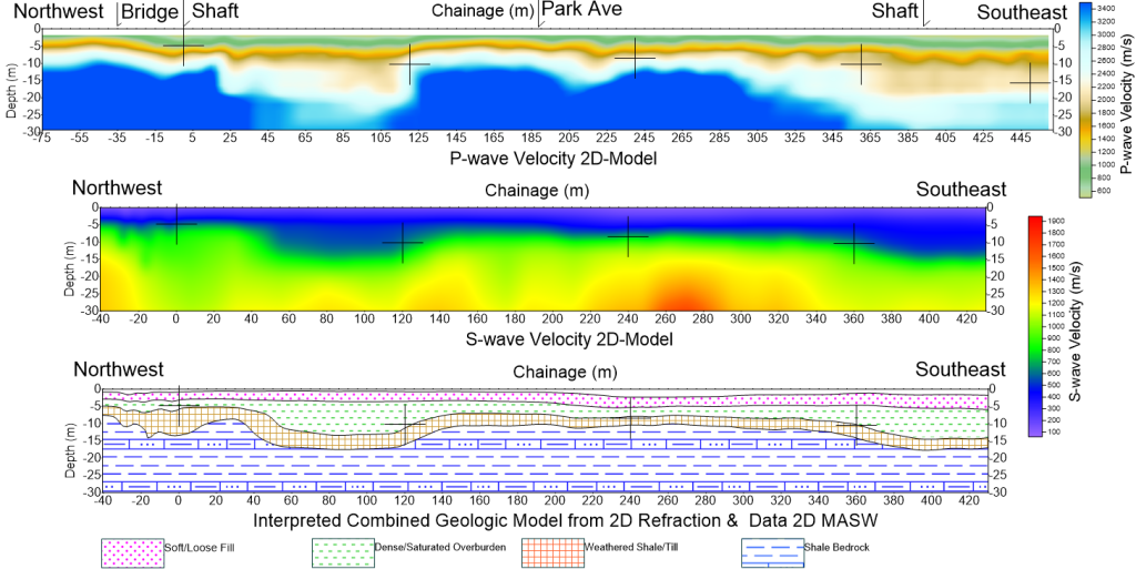
- Compiling the usage of Seismic Refraction, Seismic Reflection & HVSR points.